


29111 - CHOESTOE Voting District, Union County, Georgia
About
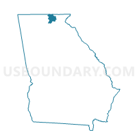
Outline

Summary
| Unique Area Identifier | 563015 |
| Name | 29111 - CHOESTOE Voting District |
| County | Union County |
| State | Georgia |
| Area (square miles) | 44.05 |
| Land Area (square miles) | 43.99 |
| Water Area (square miles) | 0.06 |
| % of Land Area | 99.87 |
| % of Water Area | 0.13 |
| Latitude of the Internal Point | 34.79275280 |
| Longtitude of the Internal Point | -83.82822360 |
Maps


Graphs
Select a template below for downloading or customizing gragh for 29111 - CHOESTOE Voting District, Union County, Georgia


Neighbors
Neighoring Voting District (by Name) Neighboring Voting District on the Map
- 187CH - CHESTATEE Voting District, Lumpkin County, GA
- 281833 - MACEDONIA Voting District, Towns County, GA
- 2913 - OWLTOWN Voting District, Union County, GA
- 2915 - SUCHES Voting District, Union County, GA
- 2916 - TRACKROCK Voting District, Union County, GA
- 311021 - BLUE RIDGE Voting District, White County, GA
- 311071 - ROBERTSTOWN Voting District, White County, GA
- 311091 - TESNATEE Voting District, White County, GA
Top 10 Neighboring County Subdivision (by Population) Neighboring County Subdivision on the Map
- Cleveland CCD, White County, GA (16,967)
- Three Sisters Mountain CCD, Lumpkin County, GA (13,471)
- Blairsville CCD, Union County, GA (12,739)
- Helen CCD, White County, GA (2,712)
- Macedonia CCD, Towns County, GA (2,669)
- Suches CCD, Union County, GA (836)
Top 10 Neighboring Unified School District (by Population) Neighboring Unified School District on the Map
- Lumpkin County School District, GA (29,966)
- White County School District, GA (27,144)
- Union County School District, GA (21,356)
- Towns County School District, GA (10,471)
Top 10 Neighboring State Legislative District Lower Chamber (by Population) Neighboring State Legislative District Lower Chamber on the Map
Top 10 Neighboring State Legislative District Upper Chamber (by Population) Neighboring State Legislative District Upper Chamber on the Map
Top 10 Neighboring 111th Congressional District (by Population) Neighboring 111th Congressional District on the Map
Top 10 Neighboring Census Tract (by Population) Neighboring Census Tract on the Map
- Census Tract 9601.02, Lumpkin County, GA (6,004)
- Census Tract 9502.03, White County, GA (5,129)
- Census Tract 2.01, Union County, GA (2,802)
- Census Tract 9501, White County, GA (2,712)
- Census Tract 9602, Towns County, GA (2,669)
- Census Tract 2.03, Union County, GA (2,018)